UPL Launches Smoke and Fire Events Platform to Manage Crop Risk from Wildfires
26 April 2021, KING OF PRUSSIA, Pa: UPL today announced a strategic collaboration with 6th Grain, a digital agriculture technology company, to launch Crop S.A.F.E. (Smoke and Fire Events Platform), an online application for growers and other food channel decision-makers to manage risk from smoke hazards during the fire season.
Also Read: A high-tech response is helping countries win battle against desert locusts
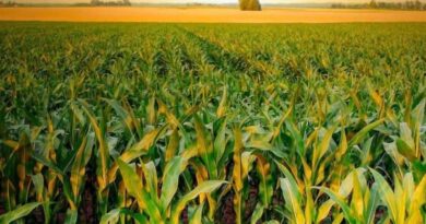
Every year, wildfires have a devastating financial impact on fruit, vegetable and other crops in the western United States. California and surrounding states are currently experiencing severe drought conditions, heightening the risk of smoke damage for the 2021 growing season.
Using advanced Earth observation data captured from the National Oceanic and Atmospheric Administration (NOAA), Crop S.A.F.E. provides remote information and intelligence to help growers and the food value chain anticipate the effects of atmospheric conditions on the crop. The platform, accessible at UPLcropsafe.com, delivers critical live updates and dataon a variety of factors that affect crop production, including smoke taint, temperature history, daily ozone and particulate data, air quality, wind direction and more.
“Through our OpenAg purpose, UPL is committed to collaborating with innovative partners to overcome some of the most pressing challenges in agriculture to help secure a sustainable food supply for all,” says Stefano Matozzo, Business Excellence Lead, UPL. “Our partnership with 6th Grain will provide immediate and direct support to growers and their crop advisors via an interactive platform to help manage risk and enable more informed crop management decisions to help overcome the effects of the wildfires.”
“Our partnership with UPL with delivering this platform is an important part of 6th Grain’s global commitment to provide digital solutions to drive evidence-based decisions and improve productivity throughout the agriculture value chain,” says Molly Brown, Chief Science Officer, 6th Grain. “Crop S.A.F.E. is an important fact-based digital tool for stronger fact-based crop management decisions and greater sustainability in the food channel.”
In grape production, for example, wildfire smoke reduces the amount of sunlight reaching the vineyard, increasing the stress level on the crop and quality of the fruit. Wildfires can also cause smoke taint in grapes, altering the flavor and reducing the marketability of the crop.
Crop S.A.F.E. uses Aerosol Optical Depth (AOD) from NOAA to estimate the intensity of smoke exposure accumulated over a period of time. The satellite-derived map shows regions with high accumulated risk of smoke taint for grapes and other produce, plus
sensitive agricultural activities such as harvesting. The online resource estimates the intensity of smoke and other atmospheric hazards, such as ozone and particulate matter levels, plus temperature history on an interactive online map to help inform crop management and harvest decisions.
By merging information on field management with satellite observations of weather, crop extent and crop health, growers will have timely, comprehensive and accurate information to improve decision-making and increase productivity.
“The direct application of breakthrough digital technology and science is key to establishing profitable and productive agriculture and food systems,” adds Matozzo. “We look forward to strengthening crop production across the country through data, modeling and evidence-based decisions.”