Use of Modern Technology for Crop Production Forecasting
3 min read
Share this
03 August 2021, New Delhi: The Ministry of Agriculture & Farmers’ Welfare is funding various projects for Crop Production Forecasting, which includes FASAL Scheme (Forecasting Agricultural output using Space, Agro-meteorology and Land based observations) and CHAMAN (Coordinated Horticulture Assessment and Management using geo-iNformatics).
FASAL is used for crop production forecasting of field crops while CHAMAN is for horticulture crops. In both the projects, Indian Space Research Organization (ISRO) has played a major role in developing methodologies. However, currently the programmes are being operationalized by Mahalanobis National Crop Forecast Centre (MNCFC) of Department of Agriculture & Farmers’ Welfare, with technology support from ISRO.
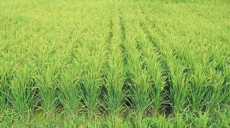
Nine crops which are assessed under FASAL are Rice, Wheat, Tur, Rabi Pulses, Rapeseed & Mustard, Rabi Jowar, Cotton, Jute and Sugarcane. The seven crops which are being assessed under CHAMAN project are Potato, Onion, Tomato, Chilli, Mango, Banana and Citrus.
The Government is using satellite based estimates for planning and decision making purposes with respect to storage, pricing and import/export. In addition to this satellite based indices are used for drought assessment and satellite data is also being used for various applications under Pradhan Mantri Fasal Bima Yojana (PMFBY), Crop Intensification in Rice fallow areas and horticulture expansion in North-eastern States.
The Government has identified various advanced technologies which includes Space and Geo-spatial technology as one of the major technologies. Areas identified for space technology applications are crop estimation, drought assessment, horticulture development, crop insurance, pest & disease impact assessment, crop loss assessment, soil resource mapping, crop intensification, precision farming, sustainable agriculture and climate change impact on agriculture.
The KISAN project launched by Ministry of Agriculture & Farmers’ Welfare carried out various pilot studies for evaluating the role of satellite technology in crop yield estimation. Based on these studies and many consequent pilot studies carried out by the Ministry, currently, the satellite remote sensing is being used for various operational applications under PMFBY, such as Smart Sampling for Crop Cutting Experiments (CCEs), Yield Dispute Resolution and Direct Yield Estimation. The PMFBY guidelines have devised SoPs for use of satellite data for various aspects of crop insurance.
The Government of India proposes to migrate to technology based yield estimation from the conventional CCE based yield estimation. Towards this, the Government is conducting large-scale pilot studies by engaging various agencies. During Kharif 2019, pilot studies were conducted by 13 agencies in 64 districts of 15 States for 9 crops which were validated during Rabi 2019-20 in 15 blocks of 6 States.
In Kharif 2020, large-scale pilot studies were conducted for Rice crop in 100 districts of 12 States by 8 agencies, which is being continued in Rabi 2020-21 for Rice and Wheat crop in 100 districts of 13 states. In addition, request for Expression of Interest (EoI) has been floated for conducting pilot studies in non-cereal crops.
Government of India have also rolled out smart sampling for Rice, Wheat, Rabi Jowar, and Rapeseed and Mustard crops during last 4 seasons.
Protocols have also been prepared for Two-Step Yield Estimation where technology will be used initially for loss categorization and then more CCEs will be conducted in ‘moderate’ or ‘severe’ areas and less CCEs will be conducted in ‘mild’ or ‘normal’ areas.
This information was given in a written reply by the Union Minister of Agriculture and Farmers Welfare Mr. Narendra Singh Tomar in Lok Sabha today