22 February 2022, New Delhi: With the central government pushing for an array of digital technologies to propel agricultural growth, researchers at the International Crops Research Institute for the Semi-Arid Tropics (ICRISAT) used high-spatial resolution satellite derived data to assess optimal numbers of crop cutting experiments (CCEs) that can be undertaken to improve crop yield estimations
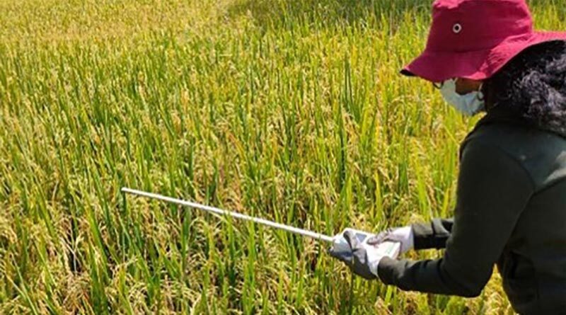
The CCE is an assessment method deployed by governments to assess crop yield in a region. Produce from the CCE are then tested on various parameters such as biomass weight, grain weight, moisture, crop management practices and other indicative factors for crop yield estimations.
Data from CCE is used by the governments for planning agricultural schemes, policies and programmes. It also helps insurance companies and financial institutions with all the inputs they need before offering loans or insurance coverage in case of poor harvest or crop failure.
Moving forward, the government of India plans to optimize CCEs using different technologies including satellite derived metrics on crop performance and spatial variability to guide the selection and number of ground data sites. The idea is to develop technology-driven approaches for direct yield estimation at gram panchayat level.
As part of a pilot project undertaken by ICRISAT in partnership with Mahalonobis National Crop Forecasting Center (ministry of agriculture, India) between June, 2019 and February 2020, researchers assessed four crops – groundnut, chickpea, rice and maize in five districts spread across three states (Andhra Pradesh, Telangana and Odisha). Objective of the study was to assess CCEs using spatial statistical optimising technique for major crops of kharif season in the districts.
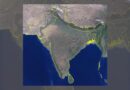
Based on the spatial data using Sentinel-2 satellite, the researchers conducted CCEs. As a part of the analysis, researchers identified few mandals in Krishna, Anantapur and Kurnool districts in Andhra Pradesh, Puri district in Odisha and Mahbubnagar in Telangana to test the methodology.
“In this study, we used the technique of re-parameterization of crop simulation models based on the several iterations using remote sensing input such as leaf area index (LAI) as it is supposed to be the highest degree of integration,” read the research paper.
The essence of the data collection was to improve the parametrization of the crop growth model and augment simulation with the use of remotely sensed observations.
While the study suggested that incorporation of LAI can improve crop yield prediction, researchers pointed out that it poses a few challenges which if resolved can further improve the yield prediction.
The spatial yield distribution of Maize of Mahabubnagar district.
This includes collection of cloud-free time-series remote sensing data during the cropping season for assimilation of data in crop models for improving modeling efficiency, studying the relationship between remote sensing derived LAI product and final yields of various crops especially in rain-fed regions among others.
“Further improvements of the Sentinel 2 derived LAI and vegetation index products are necessary, especially during the beginning of the growing season and continuous data during the crop growth period. Availability of location-specific weather data is the key for proper simulations with crop simulation models,” read the research paper.